
Maps
Constantly updated
Table of Contents
Some interesting maps that can be found elsewhere on the web:
The University of New Hampshire DIMOND LIBRARY, Documents Department
& Data Center has posted on their website historic USGS maps of New
England. These include a 1916 and 1942 Liberty,
ME Quadrangle, USGS 15 Minute Series, Latitude 44.375 Longitude 290.625.
The southeast corner of this quadrangle shows Liberty, The Kingdom, Montville and McFarlands
Corner.
Map of Native
American Tribes, Culture Areas, and Linguistic Stocks.
Map showing European
migrations to the New England states, New York and New Jersey.
Map of the Pequot
War battlesites 1637 (Rhode Island and Connecticut coastal area).
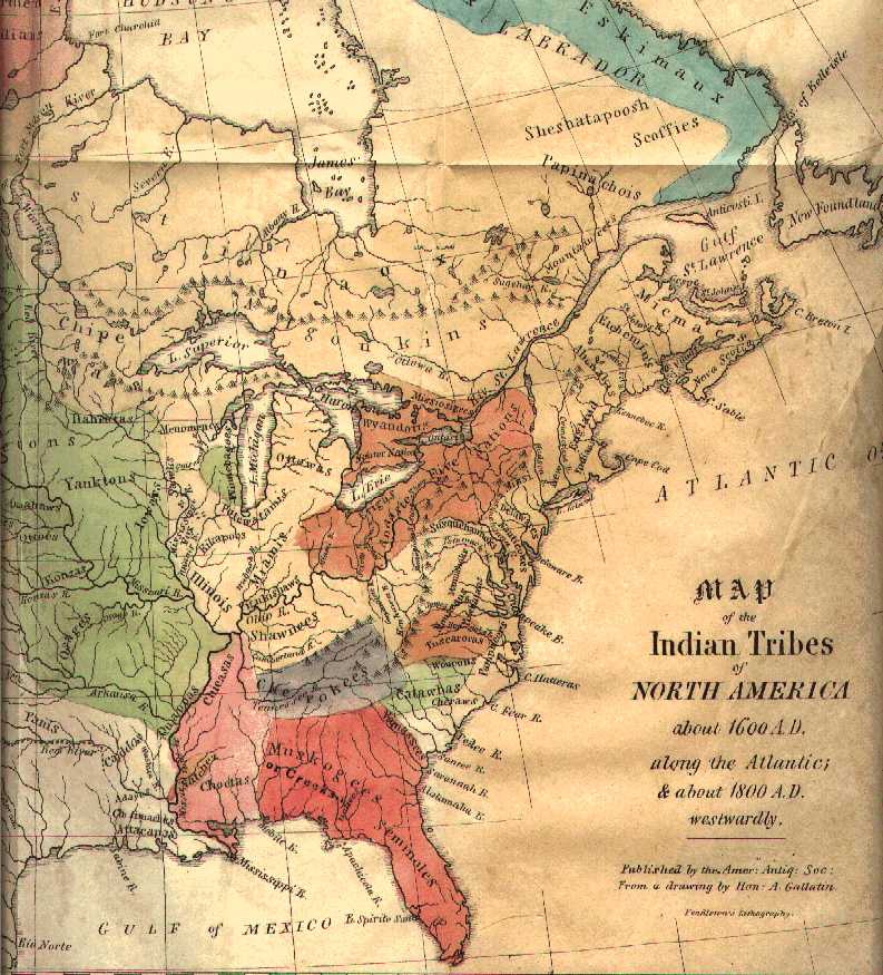
Map of the Indian
Tribes of North America about 1600 AD. (From Albert Gallatin's "A synopsis
of the Indian Tribes of North America", 1836.)
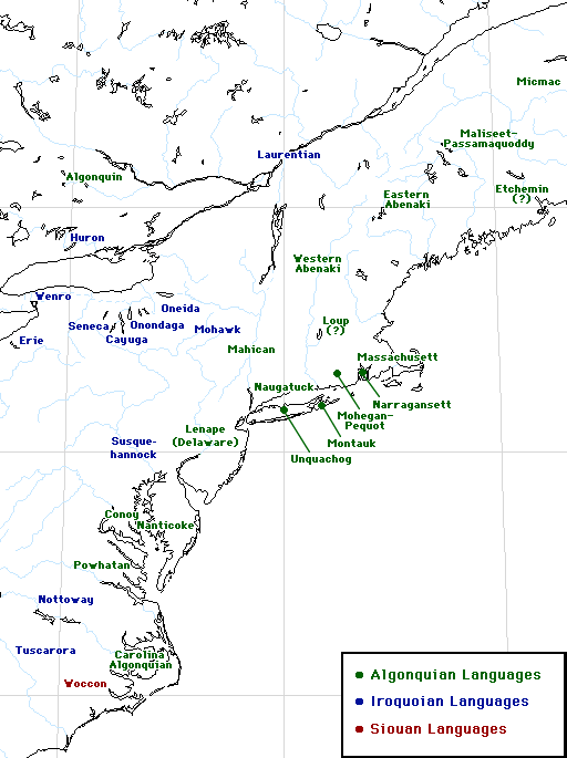
Map of the Atlantic
(Native American) coastal languages.
Map Indian Peoples
of the Dawnland, placed on the web by the Native American group
Ne-Do-Ba: Abenaki in Western Maine.